Welcome everyone! If you’ve read my blog over the last few years, you know I’m working on a personal project called NYTIP. While work on that project continues, I’d like to devote a miniseries to my current locale, New Rochelle. Introducing NROTIP (pronounced NEW-ro-TIP) – a collection of ideas for improving transport, walking, and biking in New Rochelle!
Note: Click any image to enlarge.
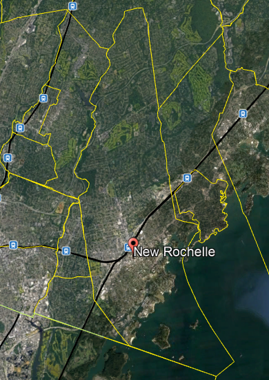
[Fig. 1] The city of New Rochelle, NY.
Elements of NROTIP
My vision for NROTIP builds on key elements of the New Rochelle Downtown Revitalization Initiative, or DRI. These elements are as follows:
The LINC
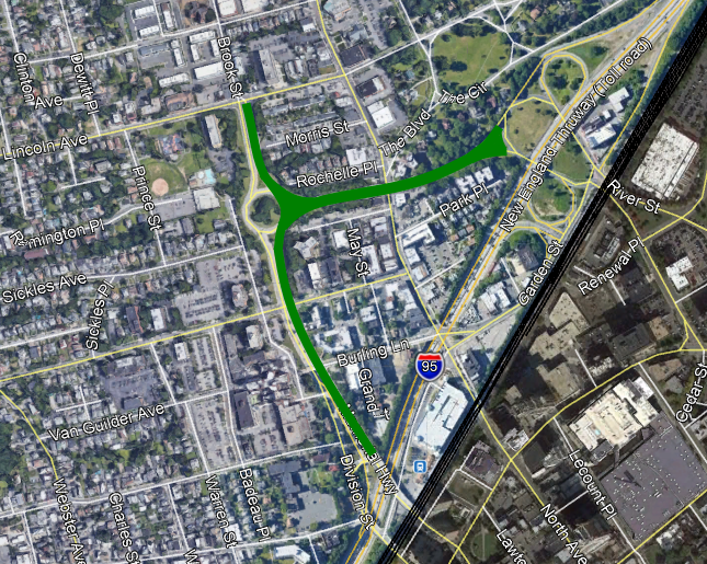
[Fig. 2] Overview of The LINC. This is my interpretation based on known information – actual design may differ.
The LINC – one of six fully-funded DRI projects – seeks to transform part of the underutilized Memorial Highway into a linear park and pedestrian/bicyclist gateway to downtown New Rochelle. In NROTIP, I will expound on my vision for this corridor. This project will likely be a catalyst to safer streets and protected bike infrastructure in New Rochelle, which brings me to…
Complete Streets and Bicycle Infrastructure
Another fully-funded DRI project is Complete Streets. This project brings traffic calming measures to several major arteries in New Rochelle. It also introduces bike lanes, which currently don’t exist anywhere in the city. The current plans include unprotected bike lanes, which is an issue.
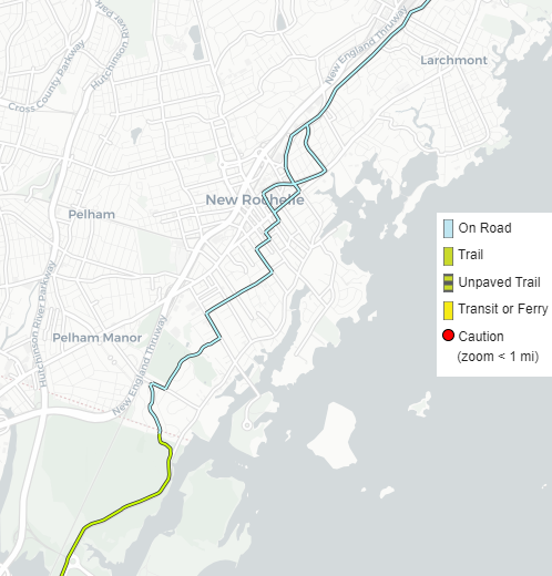
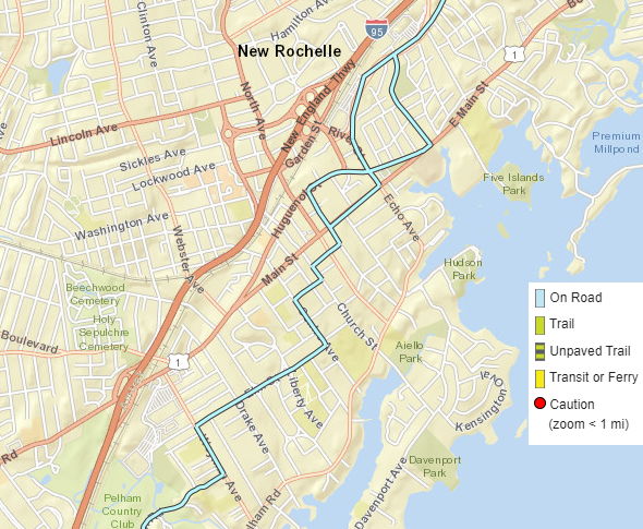
Building off The LINC, the next step in NROTIP is creating a bicycle network that conforms to the updated NACTO standards for accessibility. The network should include provisions for expansion to neighboring areas, such as Larchmont, Pelham, and The Bronx. One way to realize this is using the East Coast Greenway route:
[Figs. 3, 4] East Coast Greenway through New Rochelle.
As the figures show, the Greenway traverses roads for its entirety within New Rochelle. The Greenway, combined with The LINC and complete street treatment of arterials, should provide a starting point for a cohesive bicycle network in New Rochelle. (The other is bringing back bike share – per a recent DRI meeting, we may get a soft launch of the new bike/scooter share this summer.)
The Main Street Peopleway
U.S. Route 1 forms an east-west arterial spine in New Rochelle. In downtown New Rochelle, it splits in two, with westbound traffic on Huguenot Street and eastbound traffic on Main Street. While both corridors host mixed-use residential, there are many small businesses on Main Street, not to mention New Roc City.
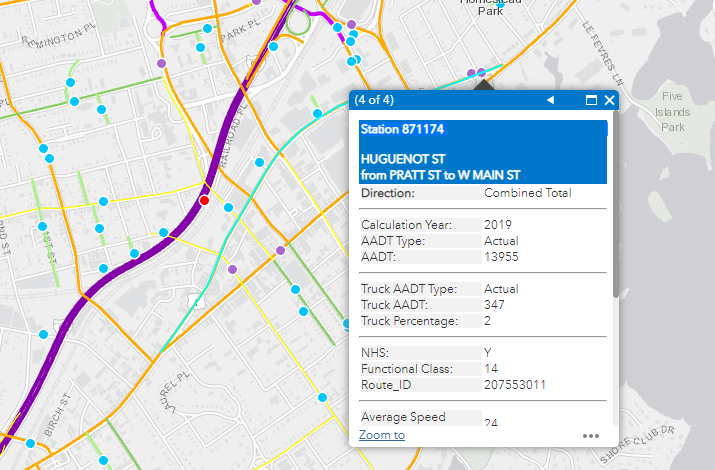
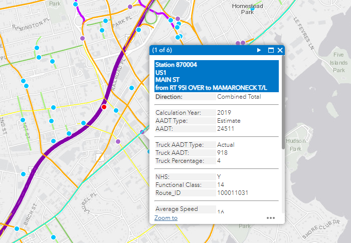
Both Huguenot Street and Main Street see high traffic volumes…
[Figs. 5, 6] Huguenot Street and Main Street Annual Average Daily Traffic (AADT), respectively. Note that the Main Street count is for both directions; the one-way stretch through downtown New Rochelle is roughly half this figure.
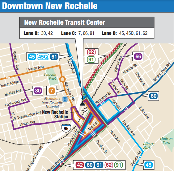
…which include a healthy mix of buses (PDF file):
[Fig. 7] Bus service in downtown New Rochelle.
The Complete Streets plan to turn Huguenot Street and Main Street from one-way to bidirectional thoroughfares presents an excellent opportunity for pedestrianization. As such, NROTIP includes the Main Street Peopleway. Inspired by Open Streets and successful busways such as Manhattan’s 14th Street, the Peopleway will only allow buses, bikes, pedestrians, emergency vehicles, and local deliveries to access the corridor, with most private traffic banned. All buses serving Huguenot Street serve Main Street instead, while private vehicles traverse Huguenot. Where space permits, Huguenot Street will also receive Complete Streets treatment.
Capping Interstate 95
In my hometown of The Bronx, a transformational project once thought to be impossible is now on the verge of reality. That project, “Cap the Cross Bronx”, proposes decking over the infamous Cross-Bronx Asthmaway with parks, housing, and more over the open-cut portions, reconnecting neighborhoods and reducing air and noise pollution.
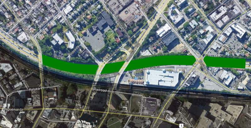
As it turns out, there is also an open-cut stretch of I-95 in New Rochelle amenable to decking:
[Fig. 8] Conceptual deck over I-95 in downtown New Rochelle.
Beginning at the Grove Avenue overpass and ending near Cottage Place just before Exit 16, this deck would reduce air and noise pollution, and open several acres of land for parks, housing, and improved connections between northern and southern New Rochelle.
New Rochelle Rail Improvements
Long-term elements include grade separation at Shell Junction (part of NEC FUTURE – PDF file), while short-term elements include station improvements at New Rochelle and service increases on Metro-North and Amtrak.
Summary
NROTIP, a subset of NYTIP, is a plan designed to encourage transportation alternatives in New Rochelle. To ensure that projected growth from new housing construction doesn’t get swallowed by traffic, getting these alternatives right is crucial. Given a projected construction start date around Fall 2022 for The LINC (now pushed back to 2023) and other projects, ample – but limited – time remains to ensure these projects reduce traffic congestion, encourage transit and other alternative modes like walking and biking, and make New Rochelle a livable place for all – whether they drive cars or not.

